Description
This item is brand-new, factory sealed.
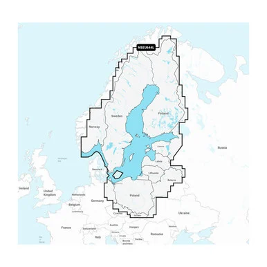
Navionics+ NSEU644L – Baltic Sea – Marine Chart
Get the world’s No. 1 choice in the marine mapping with the best, most up-to-date Navionics®+ cartography on your compatible chartplotter.
Featuring vibrant colors, a streamlined interface and combined coastal/inland content with a popular Navionics® style color palette, Garmin Navionics+ cartography makes it easy to plot your course.Multiple shading options aid in shallow water navigation and make it easy to highlight a target depth range for the best fishing spots. Fully customizable with various chart layers, overlay combinations and up to 10 color-shaded target depth ranges to scope out the best fishing spots.
When you purchase a new Garmin Navionics+ or Garmin Navionics Vision+ cartography product, a one-year subscription is included.
Chart Code – NSEU644L
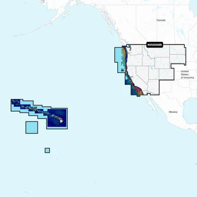
Coverage Area:
Detailed coverage of the Baltic Sea and lakes of Scandinavia and Poland. Coverage includes the Gulfs of Bothnia, Finland and Riga; the Masurian Lakes in Poland, the Szczecin Lagoon, Lake Peipus; Lakes MjØsa, Bandak and NorsjØ in Norway; Lakes Vänern, Vättern, Siljan and Storavan in Sweden; Inarijarvi, Miekojarvi, Simojarvi, and Kiantajarvi in Finland among many others.Ports include Oslo, Norway; Malmo and Stockholm, Sweden; Oulu and Helsinki, Finland; St Petersburg and Kaliningrad, Russia; Gdansk, Poland.
Features:
- All-in-one Map Solution – Access detail-rich mapping of coastal features, lakes, rivers and more.Integrated Garmin and Navionics® content offers coverage for boaters worldwide.
- Daily Chart Updates – Charts are constantly being enhanced with new and amended content — as many as 5,000 updates are made every day.The one-year included subscription gives you access to daily chart updates via the ActiveCaptain app.
- Auto Guidance+ Technology – Combining the best of Garmin and Navionics automatic routing features, built-in Auto Guidance+ technology1 gives you a suggested dock-to-dock path to follow through channels, inlets, marina entrances and more.
- Depth Range Shading – High-resolution depth range shading lets you select up to 10 color-shaded options and view your designated target depths at a glance.
- Up to 1′ Contours – For improved fishing and navigation, up to 1′ contours provide a clear depiction of bottom structure for improved fishing charts and enhanced detail in swamps, canals, harbors, marinas and more.
- Shallow Water Shading – To give a clear picture of shallow waters to avoid, this feature allows for shading at a user-defined depth.
- ActiveCaptain Community – Community-sourced content provides useful POIs, such as marinas, anchorages, hazards, businesses and more. Get recommendations from boaters with firsthand experience of the local environment.
Compatibility:
- Check the compatibility of Garmin Navionics+ content and features with your GPS chartplotter.
Technical Specifications:
- Format – MicroSD/SD Card
In the Box:
- SD/MSD Card
1Auto Guidance+ is for planning purposes only and does not replace safe navigation operations
*Sold as an Individual
Reviews
There are no reviews yet.